
In Vind AI, you can easily centralise all the GIS data you need for your wind projects, onshore or offshore, anywhere in the world. Alongside relevant built-in data, you can easily upload project data and connect with external geospatial data sources directly. Easily share relevant GIS data with the rest of the project team, while retaining control of the data.
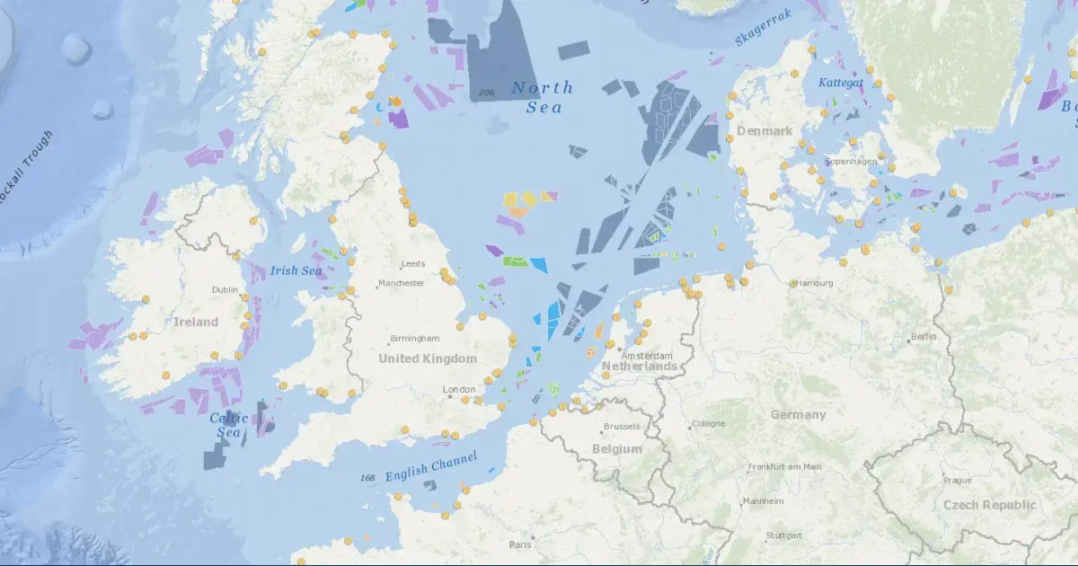
To easily get started, bathymetry and topography are embedded in the project from the start, and infrastructure like buildings, roads and existing grid close to your wind project can easily be added, in addition to more than 6000 relevant data layers including environmental and regulatory data sources.

All standard GIS data formats supported! Upload and download GIS data in standard formats to ensure compatibility with your GIS tool of choice
In Vind AI, you can connect to external geospatial data sources directly, including ArcGIS, 4C Offshore, and any other public service with an ArcGIS rest api, WMS, WFS or WMTS.
Once set up, you can browse all layers from the connection directly in Vind AI, then add and sync only the layers you need from the source.
To make sure you retain full control of your GIS data, the user control in Vind AI mirrors the user control you have within your connected GIS account like ArcGIS—but if you want to share relevant layers with the people in your project team who need access, you can easily do this directly in Vind AI.
Every time you use your GIS data from an integrated source in Vind AI, the data is fetched directly from the source, ensuring your data is always up to date. If someone in your organisation makes changes in ArcGIS for example, the changes will reflect automatically in Vind AI as well.
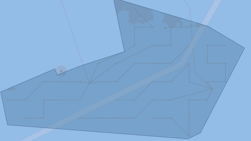
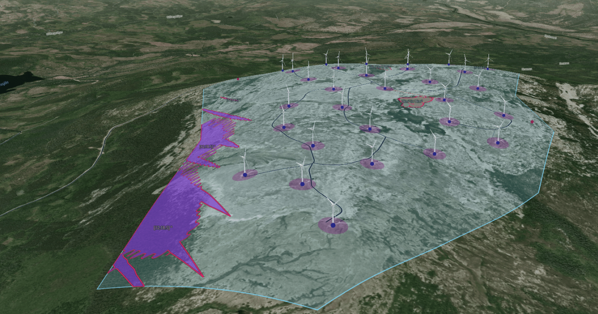
Use GIS data to identify and mark areas unsuitable for placing wind turbines, like protected areas, areas with environmental requirements or areas with topography challenges. These site constraints are then automatically taken into account when you use other relevant platform features, like the turbine layout optimisation.
With Vind AI, GIS analysts can work in the same platform as the rest of the project team, for faster and smarter collaboration.
Results of GIS analysis, like site constraints, are automatically taken into account when using other platform features in Vind AI, like the turbine layout optimisation.
Seamless integrations with your existing GIS tools saves you from spending time downloading and uploading data from one platform to another—and it ensures the GIS data used by other team members for tasks like layout optimisations is always up to date. With real-time updates, your team will always work on the latest version, eliminating errors caused by outdated files.
GIS analysts can easily share relevant data with the whole project team directly in Vind AI, while retaining complete control.


